History
of Meeniyan
An Indigenous History.
The Brataualung people are the Indigenous inhabitants of the lands where Meeniyan is situated. The Brataualung are one of the five tribes of Gippsland, and are often considered part of a wider regional grouping known as the Gunnai nation [Early Settlement of South Gippsland, John Bradshaw, Coal Creek Heritage Village, 1999 p3].
The Brataualung's traditional territories embraced some 1,900 square miles (4,900 km2), extending eastwards from Cape Liptrap and Tarwin Meadows east to the maritime outlet of the Merriman Creek. Its northern boundary reached inland to Mirboo. It included what are now Port Albert and Wilsons Promontory.
In completing a history of the founding of Meeniyan in 1981 Peg Boyd found there were differing views about the naming of Meeniyan. Her history, sponsored by the Meeniyan Progress Association to mark 100 years of the community’s founding, noted that:
“The name Meeniyan is reputed to be from an aboriginal word, ‘Maneyanin’, relating to the moon (Les Blake Place Names of Victoria, p171). Mrs Betsy Gilligan (nee Knibbs) maintained that the township was named for an Aboriginal who had a camp n the bank of the Tarwin, her name was Minnie Anne and thus the name”
[From: A History of Meeniyan: 1881-1981, a century of progress, P.M. Boyd, Meeniyan Progress Association Centenary Committee, 1981]

The Village of Meeniyan.
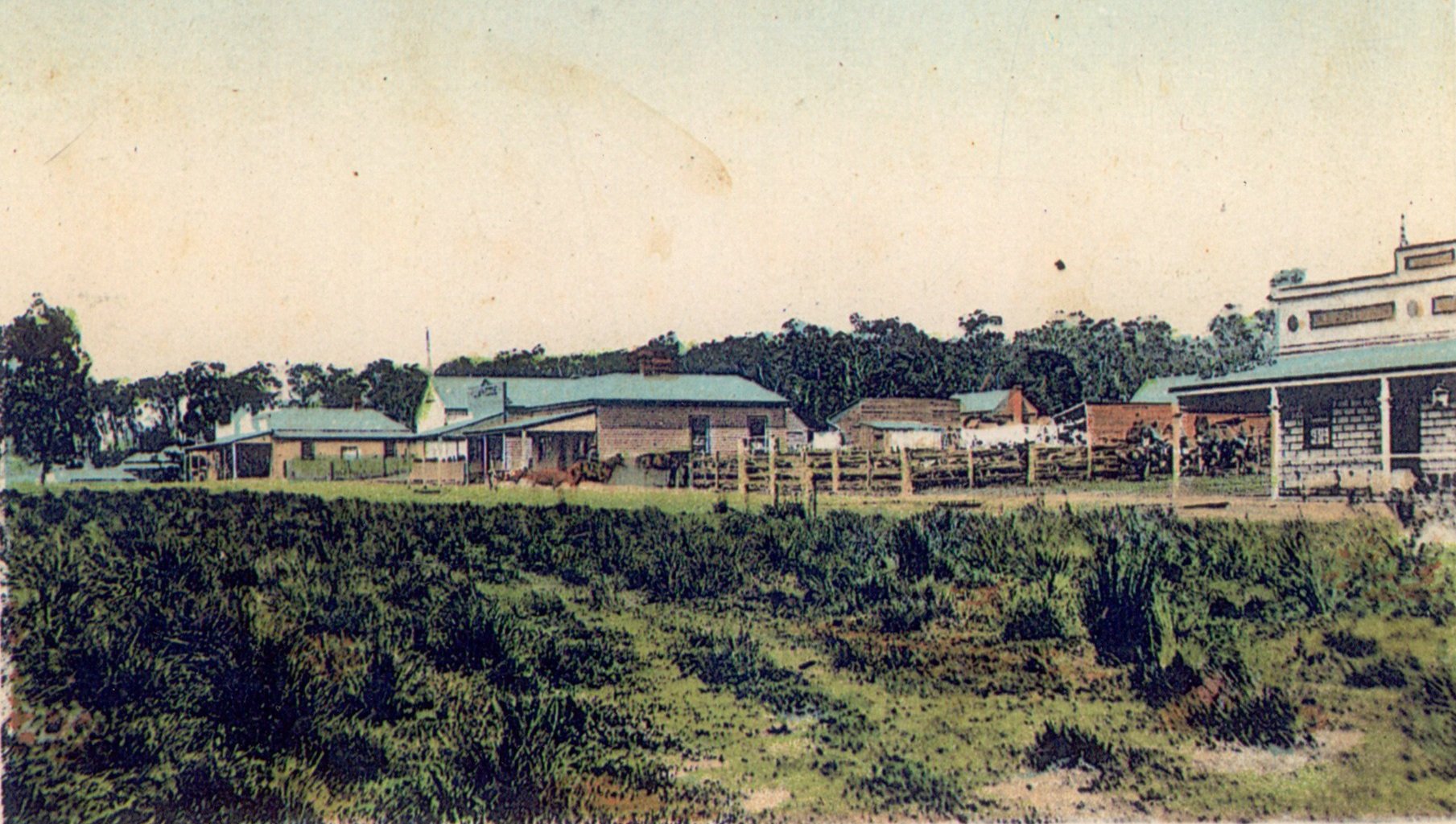
In 1876 Whitelaw [O.P. Whitelaw was a mining surveyor and registrar who supervised trackcutting operations in Gippsland] cut a pack horse track from, Korumburra to Foster. The township of Meeniyan is situated close to that first track, and Whitelaw Street commemorates it. For some years explorers had been searching for a track which would be a more direct cattle route, to the Melbourne markets. Until this time, stock would have to be driven around the coast, or by the circuitous route over the hills through Morwell […].
Although the Whitelaw’s Track gave a more direct route it was by no means an easy one. The flash floods which overnight could make the river unpassable, was one hazard which could mean a delay. Travellers on foot or horseback would sometimes take days to travel a few miles; but it was being used more frequently. Cattle were mustered in yards near where the saleyards were built. Shanties and stores sprung up along the track.
In 1878, land in South Gippsland was opened for Selection under the terms set out in the Second Land Act of 1869, and was rapidly taken up by Selectors. […] The terms required the selection to be fenced, and an area of one acre in ten cultivated before the end of a three year period. It is recorded that many early settlers, found it impossible tor meet these conditions, many others were forced to take outside work to pay for the cost their land. Some became itinerant workers, going north for shearing. When this happened their wives and families were left alone to cope with the trials of early settlement.
In 1881 Railway trial surveys were made by a party employed in the engineering chiefs branch of the Victorian Railways […]. It was not until 1887 that the final survey made the route through Leongatha via Koonwarra to Meeniyan. The Member for Gippsland, Mr Francis Conway Mason, M.L.A. used his influence to have the line brought close to the property he had leased in Meeniyan.
The township area rapidly expanded to cop with the needs of the railway camps and by 1889 Meeniyan was proclaimed a Township. In 1890 Lardner surveyed the town… [and] made provision for a Village Settlement.
From: P.M. Boyd, A History of Meeniyan; 1881-1981, a century of progress (p1-2)